ACGGP · Geoviewer · Mining and energy sector
In productionPPR ACGGP Viewer
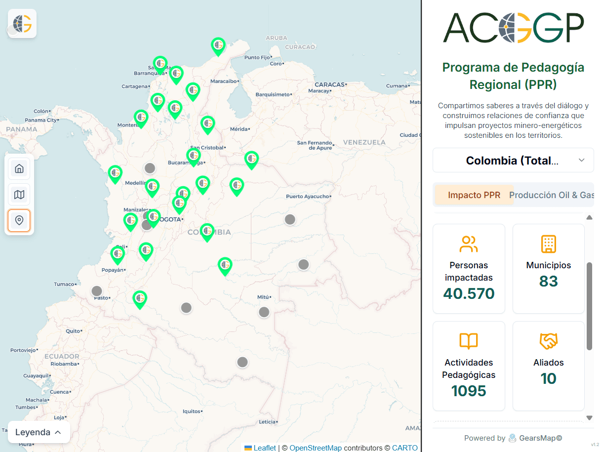
A public geoviewer for ACGGP's Regional Pedagogy Program (Programa de Pedagogía Regional, PPR). It brings the program's territorial presence and indicators onto the map of Colombia, with layers, filters, and territorial context.
The program
The PPR describes itself as sharing knowledge through dialogue and building trust around sustainable mining and energy projects in the territories. The viewer shows that work on the map.
What we built
National map
The program's locations on the map of Colombia, with a collapsible legend and a reset to the initial view.
Territorial selector
The reading starts from the national total and narrows by territory.
Two readings
Tabs for the program's impact and for oil and gas production.
Indicator cards
People reached, municipalities, pedagogical activities, and allies, readable at a glance.
Layers and locations
Tools to switch layers and explore the program's sites.
Open cartography
A basemap built on OpenStreetMap and CARTO data.
Related services
Other projects
Do you have complex territory to understand?
Tell us where the difficult data is. We design a way to make it useful.
This page describes GearsMap's work. The viewer's figures and content belong to ACGGP and can be consulted directly in the viewer.